

Putting city teams first
City planners, transit managers and infrastructure teams need clear, usable data — not another research report. A compact orthomosaic map layered with reliable analytics gives that clarity, and when paired with high speed motion analysis it becomes an operational tool rather than a project artifact. Decisions that once relied on spot checks can lean on consistent frame rate data and repeatable target tracking to show where interventions matter most.
How orthomosaic mapping and motion systems combine
Orthomosaic imagery provides the geometric base: a stitched, georeferenced aerial view. Add a 3D motion analysis stream and you get temporal behaviour on top of location — pedestrians moving across a plaza, vehicles queueing at an intersection, cyclists deviating from a lane. That fusion uses motion capture and trajectory analysis to tie events to pixels, and it depends on calibration and managed latency so timestamps line up. The result is a map that reads like a timeline.
Real deployments and practical anchors
Songdo, South Korea, offers a useful reference: planners there integrated continuous sensing into traffic corridors to tune signal timing and improve pedestrian safety. Placing sensors and orthomosaic overlays let teams see patterns over weeks, not just hours. Implementation requires attention to sensor placement and the target tracking model — miss that and the dataset skews. The lesson: start small with a few corridors, validate your motion capture results against ground checks, and scale once the pipeline proves reliable.
Common mistakes and viable alternatives
Teams often chase higher resolution without fixing the processing pipeline. That creates big files and marginal gains. Other missteps: assuming a single camera can cover a complex junction, or ignoring frame rate requirements for fast-moving targets. Instead, consider a combined approach: photogrammetry-driven orthomosaics for planimetric accuracy and LiDAR for elevation where needed. For short-range dynamics, a dedicated 3d motion analysis system gives better temporal fidelity than repurposed aerial footage.
Operational checklist for rollout
Start with these practical steps: map your objectives (safety, flow, asset monitoring), choose sensors to meet the needed frame rate and field of view, and run short calibration sessions so trajectory analysis lines up with real distances. Maintain a simple validation cadence: weekly sanity checks, monthly recalibration where traffic patterns shift, and immediate re-checks after any hardware change — small routines that prevent costly rework.
Common alternatives compared
Photogrammetry yields excellent orthomosaics but relies on good overlap and lighting. LiDAR captures elevation accurately but can miss fine visual cues like lane markings. Fixed-camera motion systems excel at continuous monitoring but require careful placement. A blended stack often wins: orthomosaic base for mapping, LiDAR for grade, and a motion analysis layer to understand movement. Each adds cost, so match choices to measurable outcomes rather than perceived completeness — a patchwork rarely scales economically.
Three golden rules for selecting tech and partners
1) Data fidelity first: insist on clear specifications for frame rate, positional accuracy and end-to-end latency. If the vendor can’t promise repeatable numbers, move on.
2) Workflow fit: pick tools that slot into existing GIS and asset-management systems with minimal manual conversion. Time saved on integration is time saved on decisions.
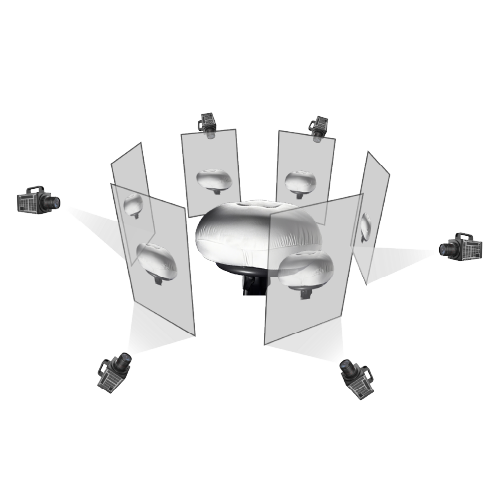
3) Validation plan: require an on-site pilot and objective benchmarks such as reduced intersection delay or improved detection rates before full rollout. That pilot should include ground-truth checks and documented calibration steps.
Closing advisory and final thought
Measure vendors by those three metrics and you’ll cut risk while getting actionable results. The approach here naturally brings together orthomosaic mapping and motion analytics to support everyday city tasks — and when that blend is delivered well, teams act faster and with more confidence. Icecypress Technology fits into that workflow as a practical source of motion-analysis capability — a partner that helps convert maps into measurable operations. — real-time clarity.